The city has two areas (Commonage and Bella Vista) largely comprised of intact, natural ecosystems.
They provide essential habitat for species at risk and represent a unique mosaic of grasslands, sparsely vegetated areas, broadleaf woodlands often associated with gully features, and woodlands.
These largely contiguous natural areas provide the city with an opportunity to lead in safeguarding unique wildlife habitats and preserving natural lands for its residents to enjoy. Source: City of Vernon Environmentally Sensitive Area Mapping Study (2025).
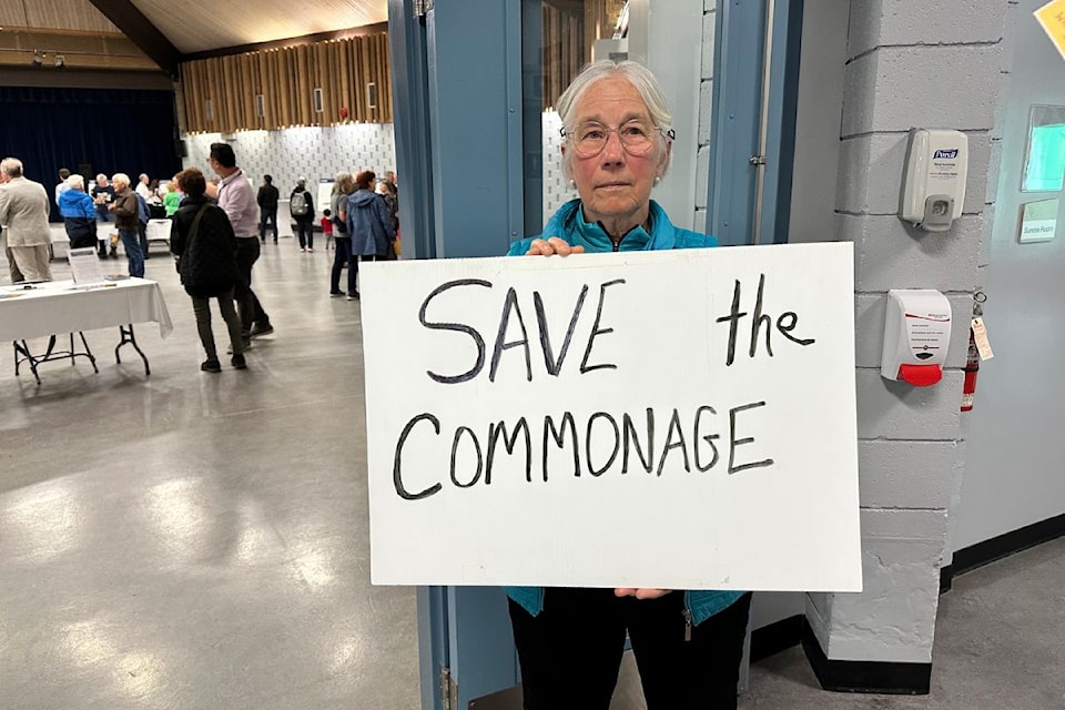
The North Okanagan Naturalists' Club (NONC) is deeply concerned about the sprawl development being proposed by Kerkhoff Develop-Build at 580 Commonage Road.
We urge council and community members to consider the longterm damage that approval of this development will visit upon our community and region.
The city is considering this proposal even though the community has repeatedly stated its opposition to further development of the Commonage lands:
• City of Vernon’s Master Parks Plan (July 2015).
• RDNO Regional Growth Strategy: One Region, One Future (updated 2019).
• City of Vernon, Housing Needs Report: 10 Key Findings (November 2024).
• What We Learned: City of Vernon Official Community Plan and Transportation Plan Update (2024).
Council is considering an OCP amendment that significantly contradicts the language and spirit of the current OCP.
At its closest point, the proposed site is five kilometres from the existing core of the city.
Current OCP states: “Avoiding urban sprawl and ensuring that development takes place where adequate facilities exist or can be provided in a timely, economic and efficient manner.
“Settlement patterns that minimize the use of automobiles.
“Protecting sensitive & essential habitats & ecosystems.“
The proposal is inconsistent with council’s 2023-2026 Strategic Plan: “Council makes decisions based on data and smart growth principles.
“Focus on protecting and enhancing local built and natural environments as a core community strength.”
This proposal plans building residential units directly in a wildfire interface area.
“…Canada risks compounding an already serious problem by allowing further development in hazardous areas…the report projects that [B.C.’s] wildfire losses will increase by more than 265 per cent, to more than $1 billion per year.” (Canadian Climate Institute, 2025).
Fourty-nine per cent of the land in this proposal is classed SER1 (High Environmental Sensitivity) and another 44 per cent is classed SER2 (Moderate Environmental Sensitivity).
The proposal will see the SER 2 areas covered with low-density residential housing leading to degradation of the adjacent SER 1 lands and destroying the ecological integrity of the site. This is not a ‘nature preserve!'
Growing concerns about increasing water scarcity in the region have been ignored.
Climate change is resulting in lower annual snowpacks. Sprawl development puts greater pressure on water supply via increased water consumption for residential and landscaping purposes, increased runoff, potential pollution of water sources and increased operational and capital costs to ensure water supply and quality.
The absence of a cost analysis makes it impossible for council and the public to understand what the long-term infrastructure and servicing costs will be to the city taxpayers.
Council and the public are essentially being asked to blindly make decisions on a business deal that will provide huge financial rewards to the developer but result in significant long-term costs to taxpayers.
The costs in terms of environmental destruction, increased infrastructure costs and other negative impacts outweigh any potential benefits.
Tell city council that Vernon residents say no to this sprawl development!
Email: mayor@vernon.ca, tdurning@vernon.ca, kfehr@vernon.ca, kgares@vernon.ca, amund@vernon.ca, bquiring@vernon.ca, bguy@vernon.ca.
Eric Kowalski,
NONC vice president

