The Fraser Valley Regional District is embarking on a formal assessment of landslide risks in the Chilliwack River Valley.
"To better understand how climate change and environmental factors contribute to landslide hazards, the FVRD is launching a Slope Stability Risk Assessment in the Chilliwack River Valley."
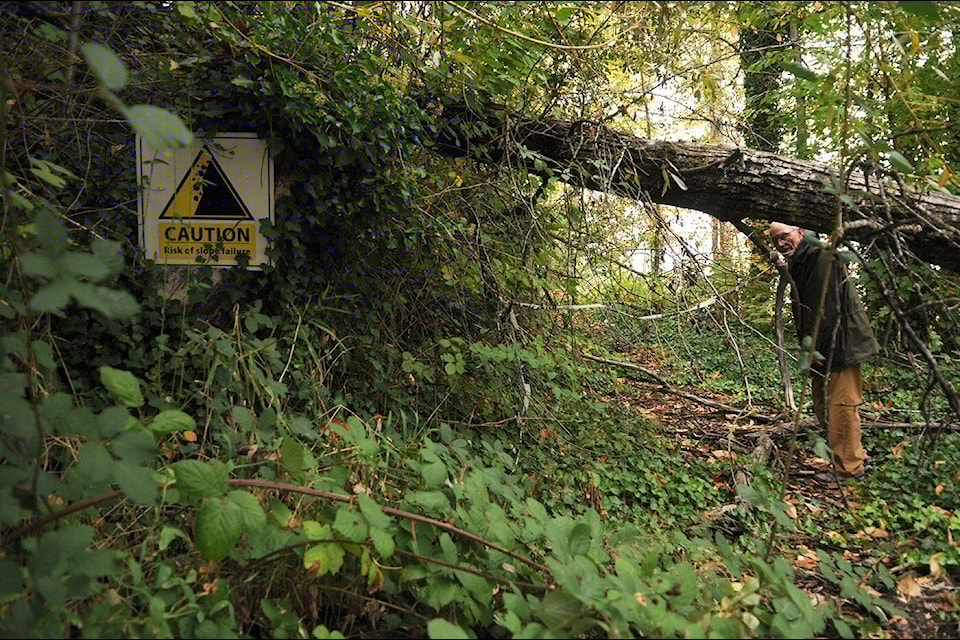
The FVRD study comes on the heels of the devastation in the CRV that accompanied the 2021 atmospheric river events, which thrust the risk of landslides in the region into sharp relief.
Led by experts, this project will help guide the FVRD to make future decisions around slope safety and land use.
The homes of six property owners in the Chilliwack River Valley were deemed uninhabitable due to landslide risk after the weather disasters of 2021, but they were not considered eligible for disaster funding.
The stymied homeowners are still frustrated after repeatedly being denied financial assistance by the provincial government in the years since.
FVRD officials announced last week the district will work with BGC Engineering to assess slide risks of the Chilliwack River Valley (CRV) in Electoral Area E with joint funding from the provincial government.
"Slope stability risk" in this context refers to the various geohazards that threaten homes and infrastructure such as: landslides, debris flows, rotational slumps, rockfall, and rockslides.
"While we recognize it is important to assess all types of natural hazards, this project focuses specifically on geohazards, rather than other risks such as flooding or wildfires," FVRD officials said in a release.
The local knowledge of area residents can help "ground this assessment in real-world experience", informing FVRD officials where risks lie and how they affect daily life in the CRV.
The project will seek to:
• understand slope hazards and risks through comprehensive technical assessment, mapping, and modelling;
• assess the safety of existing lands, infrastructure, development, and residents;
• consider future conditions, including climate change; and,
• identify strategies and mitigation options to reduce risks to the community.
The study area includes the slopes on both sides of the CRV, extending from Baker Trails in the east to the Slesse Park landslide to the west, as well as the Ranger Run area, and the subdivision at Post Creek. Communities in the CRV include Baker Trails, Bell Acres, Slesse Park, and Post Creek.
The slope stability project is being jointly funded by FVRD and Ministry of Emergency Management and Climate Readiness.
Go to https://haveyoursay.fvrd.ca/crvssra to offer feedback if you are a resident of FVRD area E, or fill out the section for those who recreate in the CRV area.


